

Morocco Cycle Touring week 4: High Atlas and, on to Rabat
7th to 13th May 2013: From Marrakesh up to the High Atlas hiking then back to Marrakesh and by train to Rabat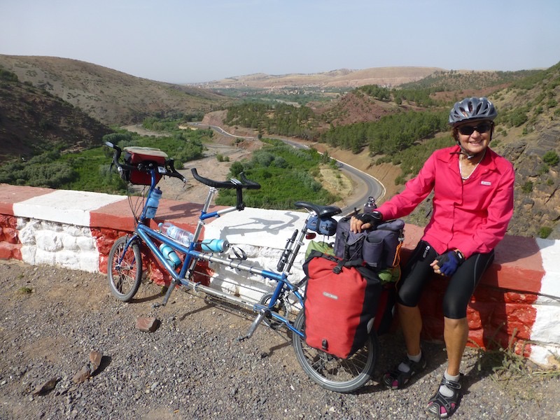
We rode South from Marrakesh about 40km into the Atlas Mountains so that meant climbing (only about 700m) to the small town of Asni.
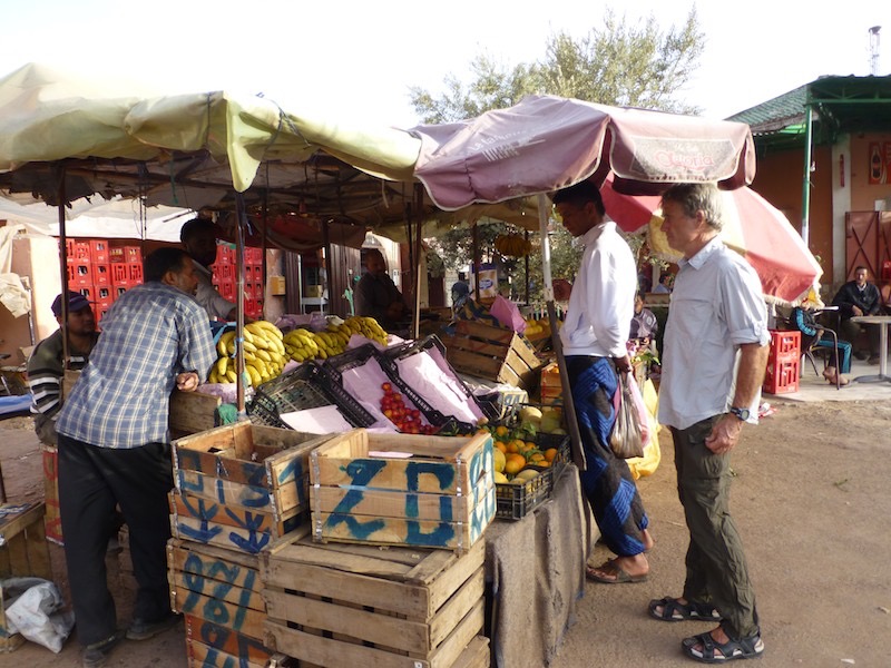
We met Mustafa and here he is shopping for our dinner in Asni
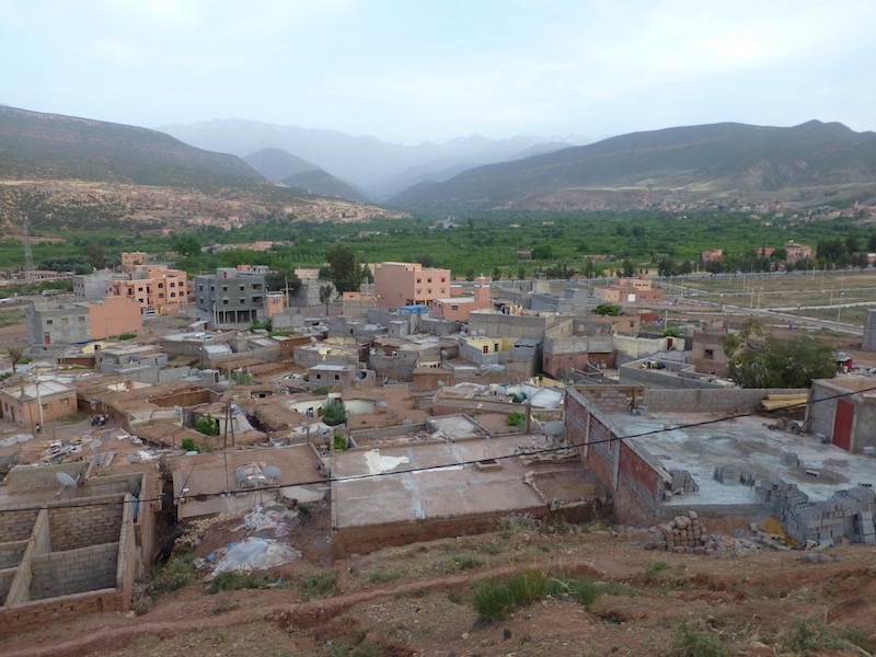
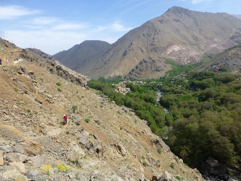
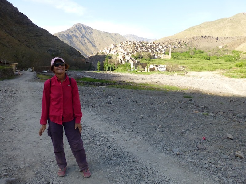
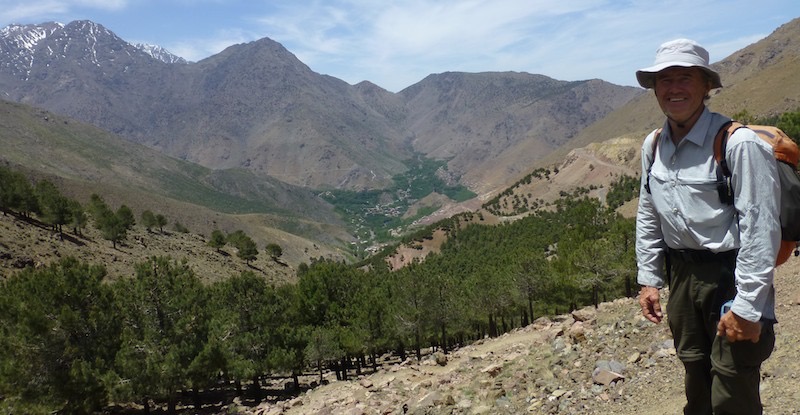
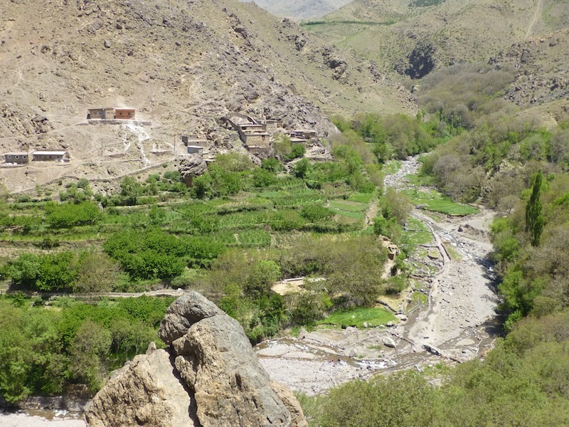
This view of Mustafa's village in Asni and the valleys up to the High Atlas where we would hike. The valley to the right is to Imlil where we caught a taxi and we hiked back via the valley on the left (Imenane Valley)
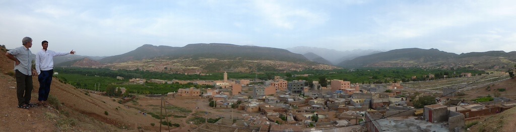
This panorama from the hill above Asni, looking towards the High Atlas Mountains.
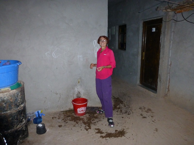
This was inside Mustafa's home, in the courtyard where the total plumbing installation was. No other tap or no drain or toilet. Our bedroom was the lounge room through the door behind Annette.
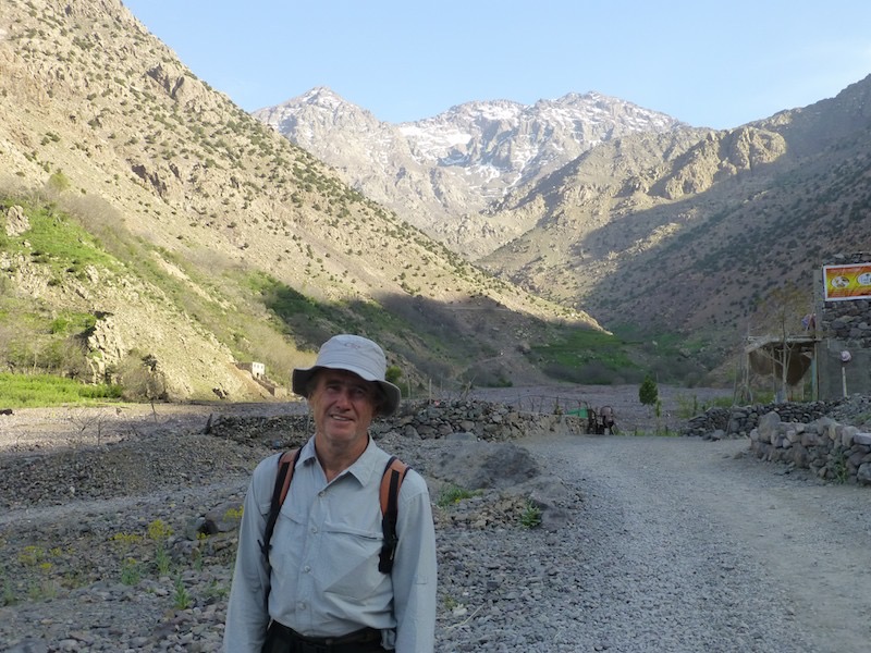
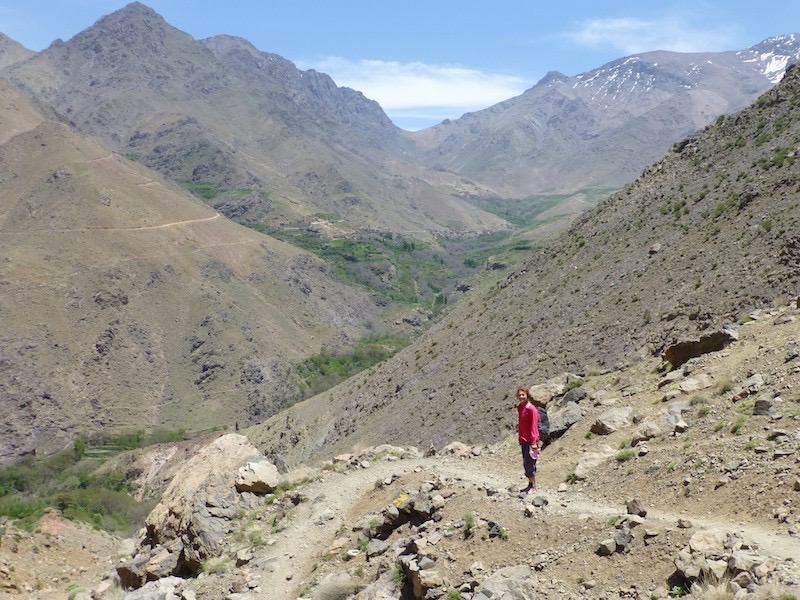
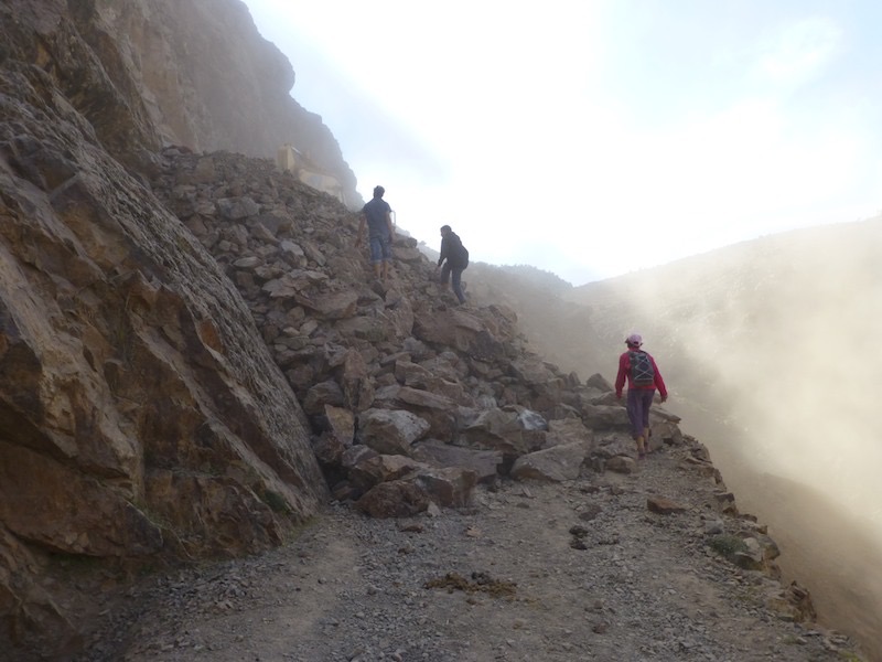
Annette climbing out from Imlil as we started hiking on Wednesday (8th May), up towards the refuge below Toubkal.
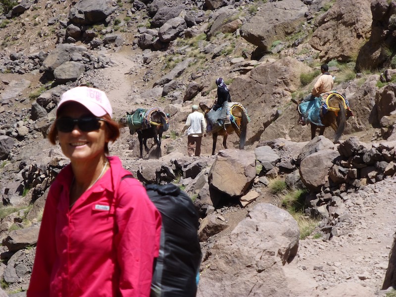
Many other trekkers had mules or donkeys to carry their kit.

The snow covered Atlas mountains.
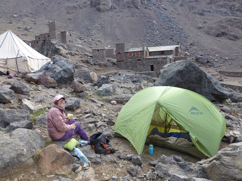
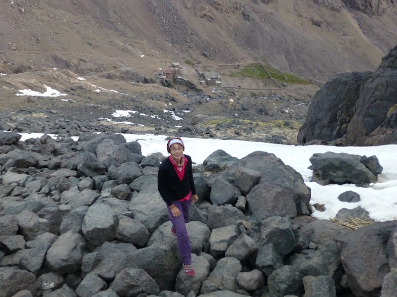
We camped on the other side of the river to the refuge and had a tagine dinner at the refuge (les Mouflons) (Dh110 each for soup, tagine and mint tea) in the lovely warm dinning room about 3200m ASL.

We were up by 5:30am and before light at 6am we were off hiking across the snow drift covered moraine away from the refuge and our camp.
Here you can see the refuges in the valley below at first light.
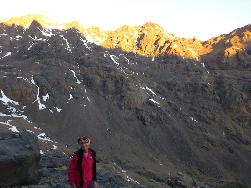
As the sun rose the mountains on the other side of the valley, to the west caught the first light.

It took us a bit over 3 hours to reach the summit of Toubkal 4167m. This is the highest mountain in North Africa. We had ascended about 1000m.
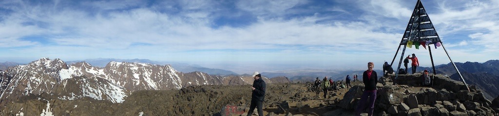
The view was spectacular and you could see for 360°.
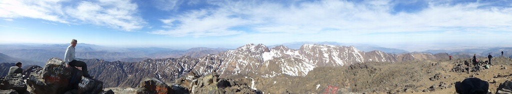
Another panorama from the summit.
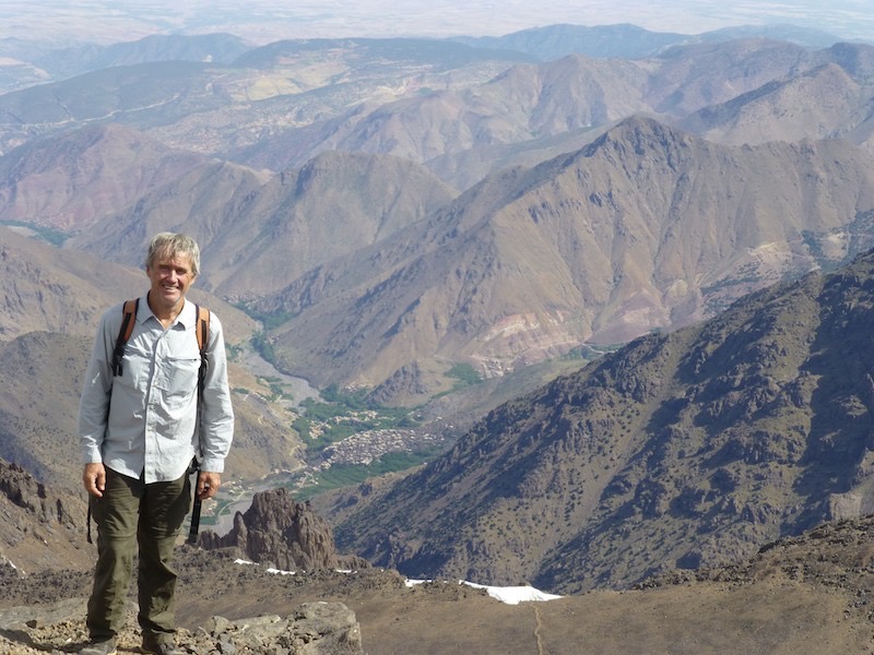
Looking back down into the valley where we had hiked up you could clearly see the village of Armed (where we ended up staying the night) (1945m) and Imlil where we had started the day before (1740m ASL)
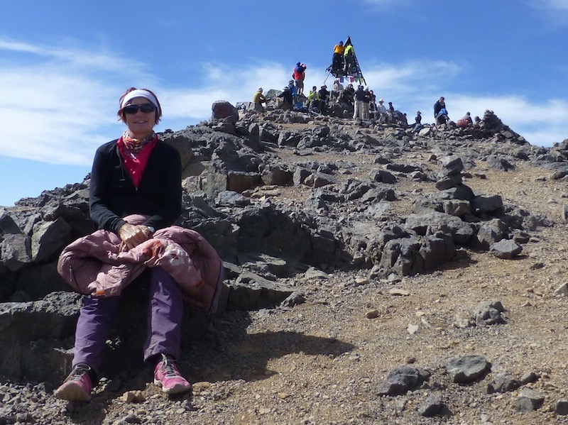
We were certainly not alone on the summit with big groups of French, German and English tourists as well as a few Australians.
After a very long day with over 12 hours hiking we reached Armed and to our delight we found a guesthouse with camping and gladly stopped for the night. (Omar le Rouge Camping Auberge)
Gary looking back up the valley where we had hiked. I think that is Toubkal on the left.
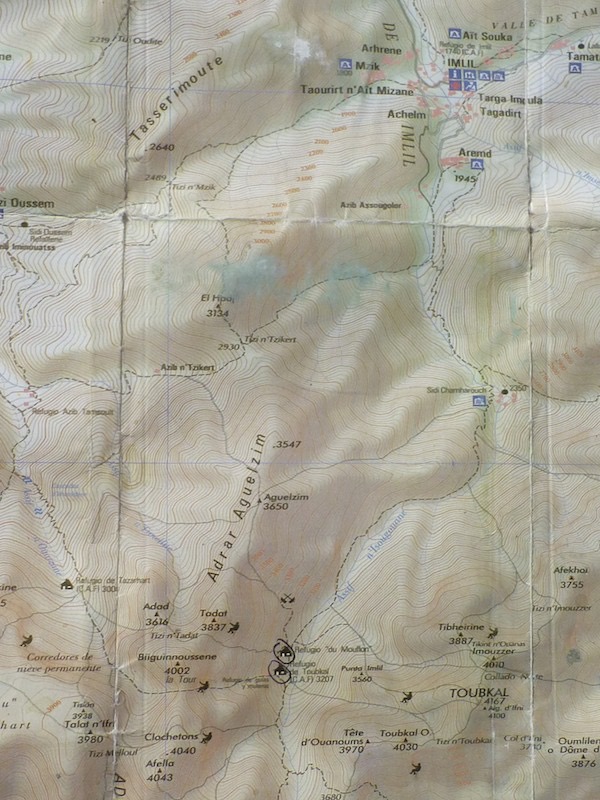
A map showing where we had hiked.
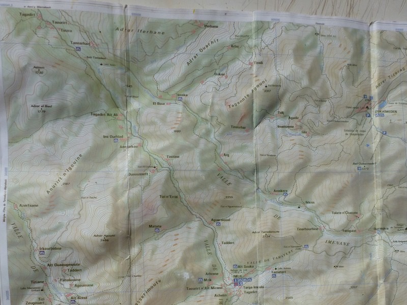
This map shows where we decided to hike on Friday. It involved hiking up over a saddle or col (Tizi n' Tamatert) and then down into the next valley (Imenane) and then along that valley back to Asni.

Here some local women in what was pretty typical attire for this area.

Annette and the col Tizi n' Tamatert after we hiked up about 500m out of the valley from Imlil.
Looking back down the Tamatert Valley to Imlil. You can see where we have walked up already.
Then over the col (saddle) and down into the Imenane Valley. A very steep switchbacked track led down to the river.

By the river women were working doing the washing
The cultivated area close to the river was a contrast to the parched mountain side. Irrigation channels directed water along the river banks.
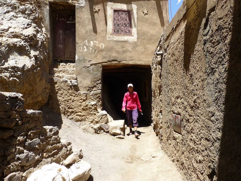
We were directed through the maze that was Tinehourhine village and included a long covered passage which Annette is just emerging from.
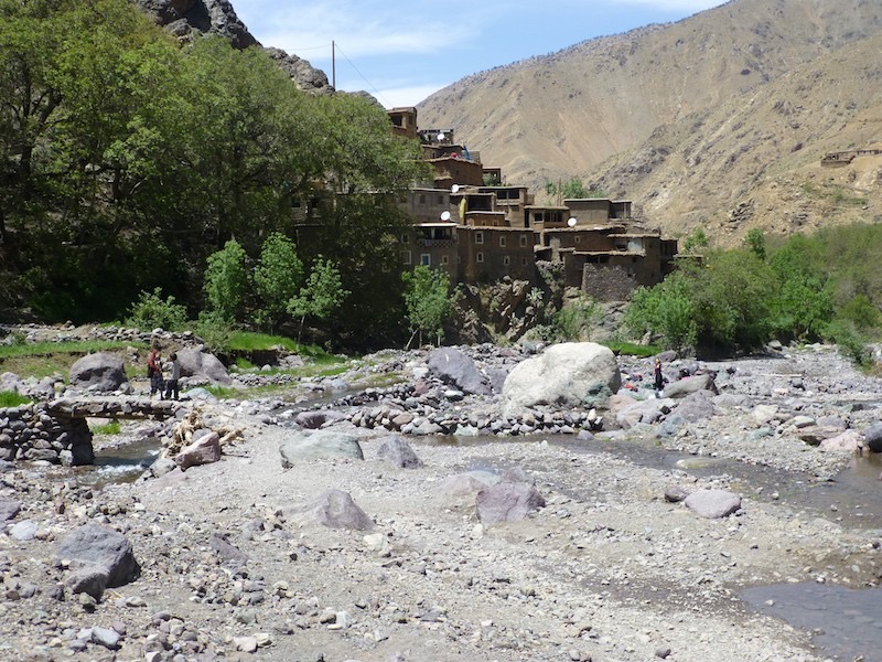
Here we are in the valley floor and cross the river on a small quaint bridge where some boys are playing with the village of Tinehourhine behind.
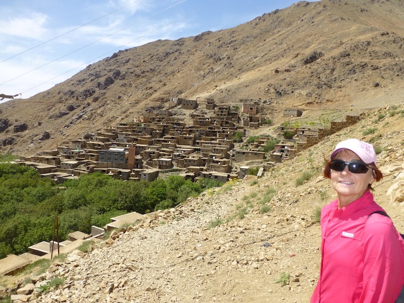
Anywhere a side stream or spring would supply drinking water there was another village built up the steep valley sides to avoid using valuable agricultural land. This I think is Ikkiss.
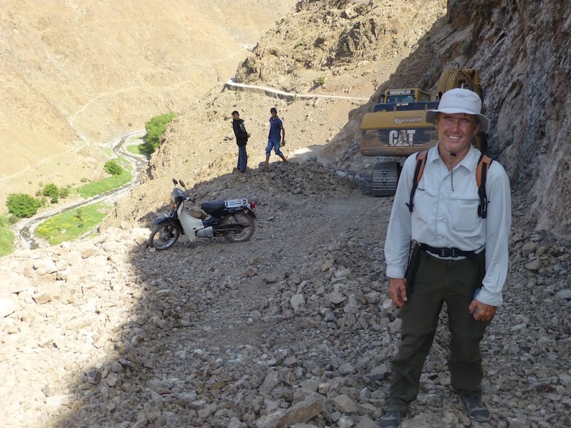
We had a topographical map and thought all would be fine without a guide but when the map showed a road along the river and there aaas none only a climb a few hundred metres to another saddle. Then there was an impasse. Fortunately two boys showed us the way and got the excavator to stop while we passed.
The river is visible well below and in the late afternoon we get advice of only 10km go. Another 5km and the good news, only 10km to go?
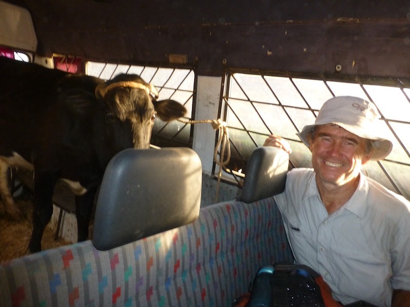
With maybe 5km to go we reach a bitumen road and as it is 7:30 and we are pretty tired (exhausted) we try hitching. Mind you there are only 2 vehicles that pass us and the second gives us a lift, in the back with the cow.
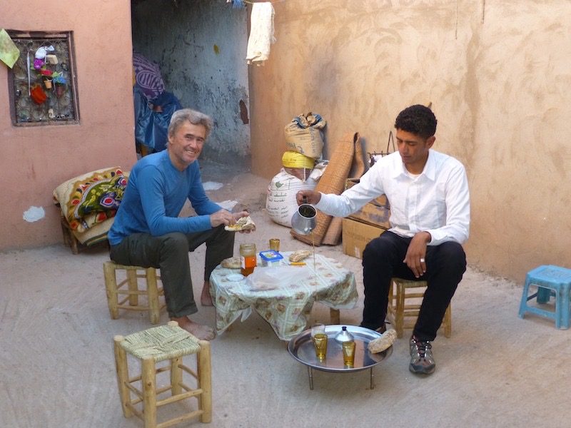
Back in Asni, at Mustafa's we have a few glasses of sweet mint tea after a relaxing hamman for Gary and bucket wash for Annette.
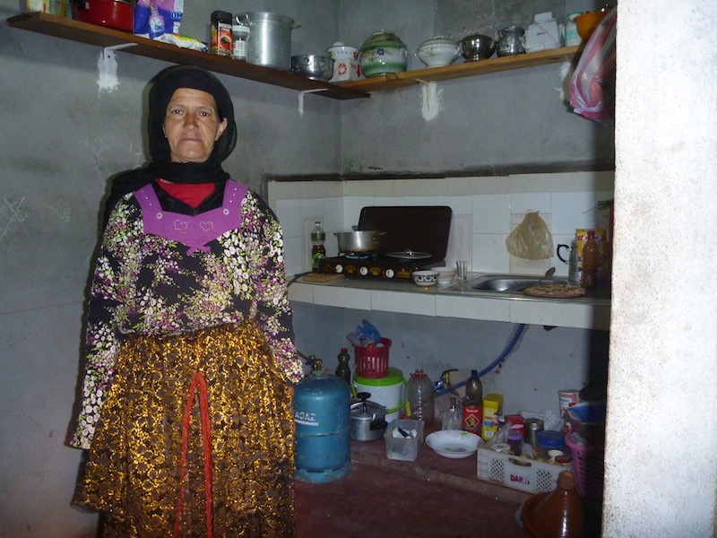
The next morning Mustafa's mother makes us breakfast in her modest kitchen.
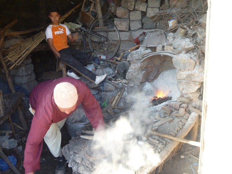
We visit the weekly Saturday market in Asni and although there are many sights, this one catches my eye, a blacksmith at work with a modified bike to power the fan and provide the air.
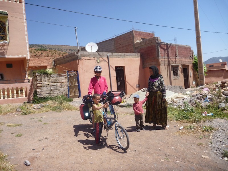
We say farewell to Mustafa's mum outside there house (the one with the television dish on top).
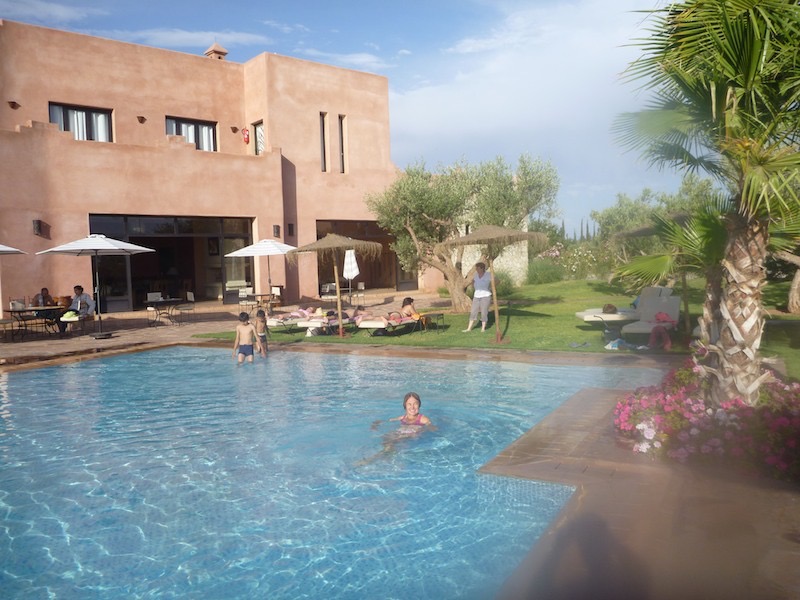
Only 40 km and mostly down hill and we are looking forward to relaxing around the pool at our campground/resort. And that is exactly what we do.

At the railway station at Marrakesh we packed up the bike and caught the train to Rabat (the capital of Morocco) 4 1/2 hour north west on the coast.

The old and the new, from our hotel rooftop, eating breakfast. The city market in front with the Medina to the right and the Ville Nouvelle to the left.

Inside the Medina this was an interesting site.. Stenographers under umbrellas, each with a regular typewriter to type letters in French and an Arabic typewriter, where the carriage went left to right (the opposite way to type right to left). In the background you may pick out a man with a bucket. There were tradesmen, either with buckets of rollers and brushes (painters) or a stand of pipes with a plumbers eel (plumbers) waiting for potential customers.
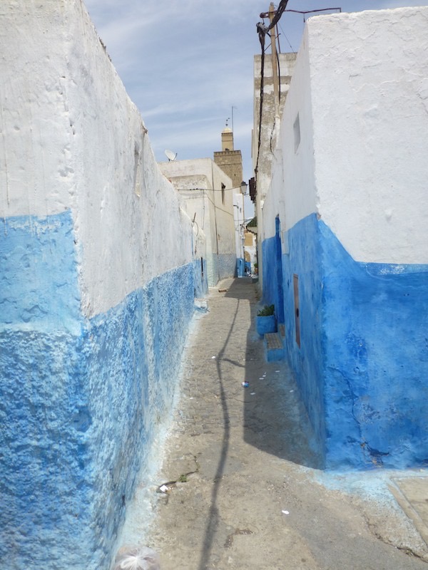
A whitewashed street in the Kasbah des Oudaias, on the headland above Rabat city. This typical alley leads down to the mosque (12th C the oldest in Rabat) and the area shows the Spanish influence.
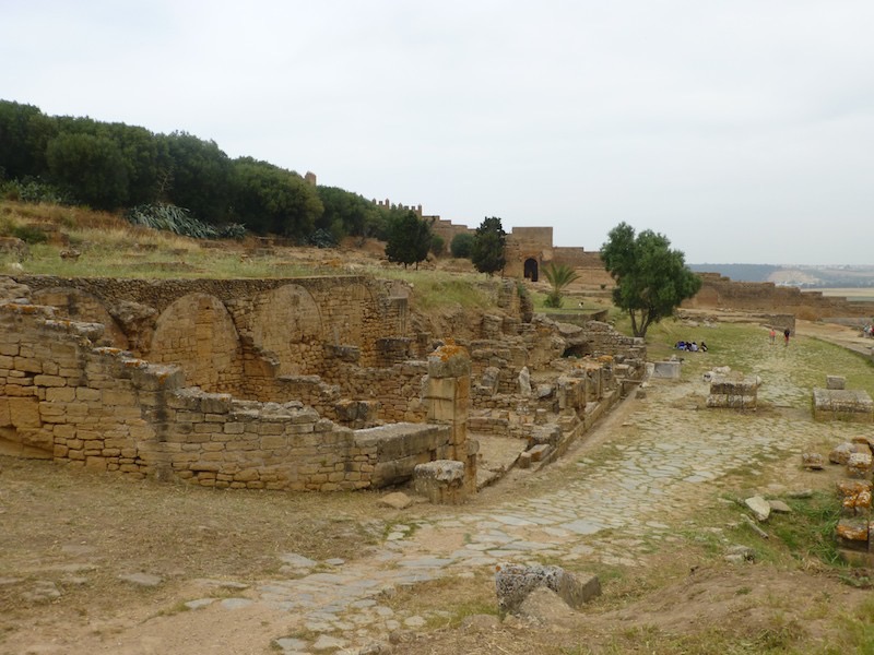
The remains of the ancient Roman city of Sala Colonia built in the 1st century. It shows the vast extent of the Roman empire. The ruins lie inside a more recent Muslim walled city of Chellah, also now in ruins.
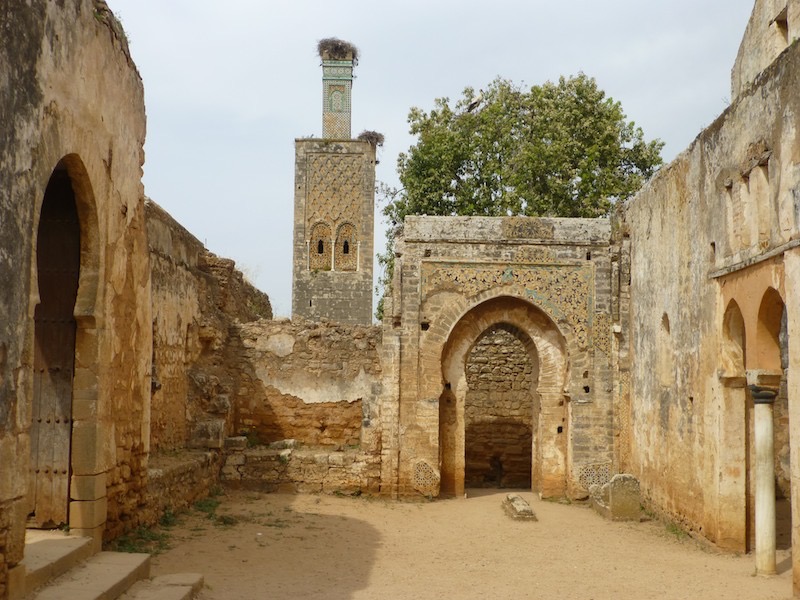
This is the minaret with storks nested on top. It is the remains of the walled city of Chellah built by a Merenid sultan in the 14th century on top of the old Roman city.
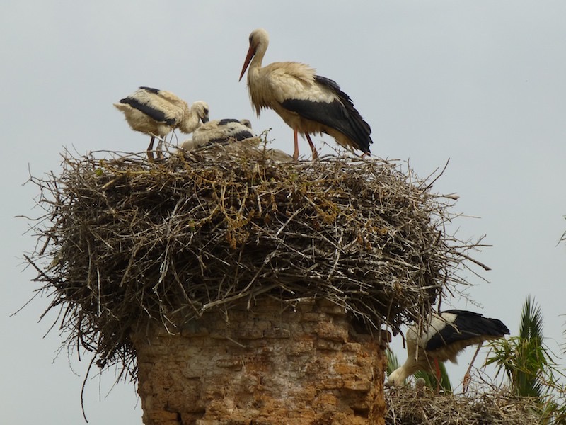
There were dozens of huge stork's nests in the Chellah compound.