

Wingecarribee R: Berrima to MacA' Crossing
03/05/15 00:14 Filed in: Wingecarribee River
- RIVER:……..….Wingecarribee River
- PUT IN:……..….Berrima Caravan Park
- TAKE OUT:…….MacArthurs Crossing
- RIVER HEIGHT:…..1.25 metres Berrima Gauge
- DISTANCE:…..……12.4 km
- TIME TAKEN: ……..4 hours 40 minutes
- MOVING TIME:……2 hours 30 minutes
- PHOTOS:…………. HERE on River Canoe Club site
- GPS MAP:…………..here on Strava or here on my site
The trip was organised by Steve from River Canoe Club.
There were 7 paddlers: Steve, Dave, Matt, Rob, John, Enmoore and me.
River Height: River Level was 1.25 at the Berrima Gauge
Start: The Start was at the Berrima Camp Ground.
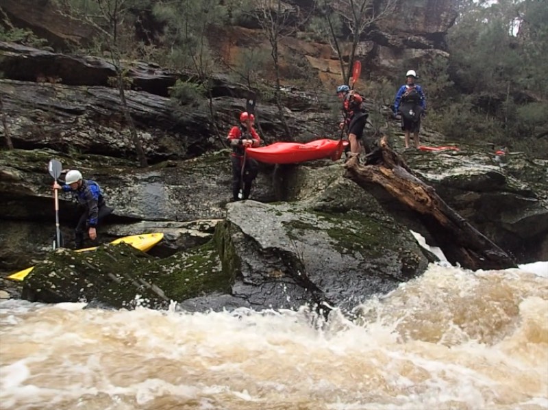
Description: The was pool drop with lots of small drops. Some of them were difficult to determine the best line. There was about 4 portages where the water disappeared under rocks.
Finish: Turn off Medway Road at Liebman Road and follow this down to a gate and then down a steep rough track to the river. The farmer (Steve) likes you to ask when you go down this track to the river.
The trip took out 4 hours 40 minutes and was 12.4 km with moving time of 2 hours 30 minutes.
HERE is a River Canoe Club link to some photos (mostly ones I took)
There were 7 paddlers: Steve, Dave, Matt, Rob, John, Enmoore and me.
River Height: River Level was 1.25 at the Berrima Gauge
Start: The Start was at the Berrima Camp Ground.
Description: The was pool drop with lots of small drops. Some of them were difficult to determine the best line. There was about 4 portages where the water disappeared under rocks.
Finish: Turn off Medway Road at Liebman Road and follow this down to a gate and then down a steep rough track to the river. The farmer (Steve) likes you to ask when you go down this track to the river.
The trip took out 4 hours 40 minutes and was 12.4 km with moving time of 2 hours 30 minutes.
HERE is a River Canoe Club link to some photos (mostly ones I took)