

Shoalhaven R: Gorge above Sewells Pt
31/03/14 00:23 Filed in: Shoalhaven River

- RIVER:……..….Shoalhaven River
- PUT IN:……..….Ningee Nimble Creek, O'Allens Rd
- TAKE OUT:…….Tmberlight Property, BIG HIKE
- RIVER HEIGHT:…..1.49 metres (gauge plot here)
- DISTANCE:…..……25-30 km
- TIME TAKEN: ……..7 hours + 1-2 hour hike out
- MOVING TIME:……unsure
- PHOTOS:…………. in HERE
- GPS MAP:…………..HERE
The trip was organised by Greg, Jiri and Kevin with Colin and I being invited along.
River Height: At the Hillview gauge (near Oallens Ford) it was 1.49 metres: SEE LEVEL HERE This was what Jiri said and they didn't want to paddle it over 1.5m
Start: We drove down Saturday night and met at Nerriga Pub at about 8:30 to do the car shuffle, leaving 2 cars on the Timberlight Property. The put in is at Ningee Nimble Creek on the Oallens Road. You carry or float your boat down the river to the Shoalhaven.
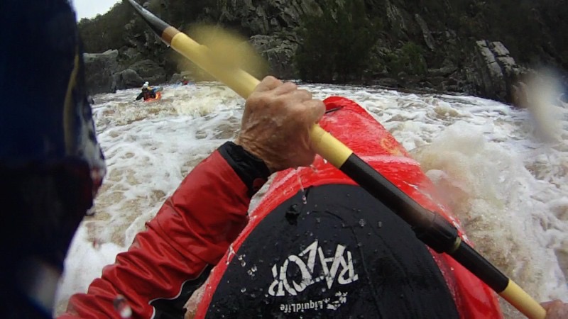
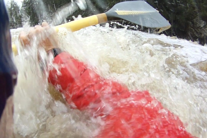
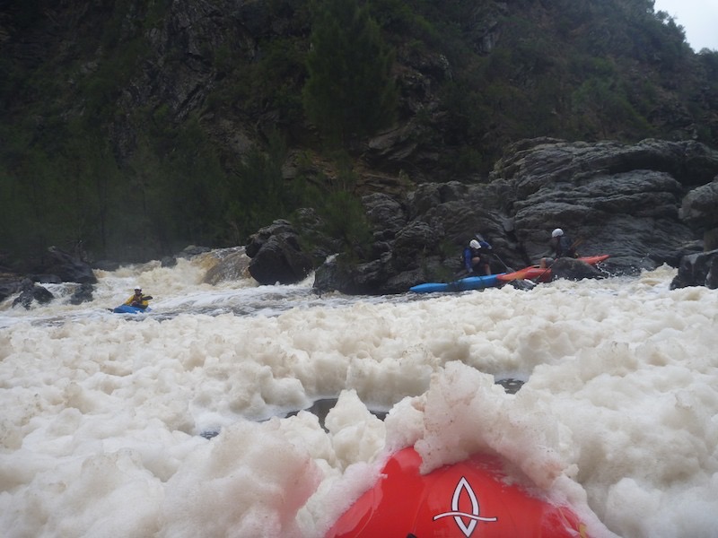
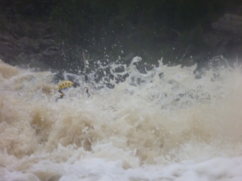
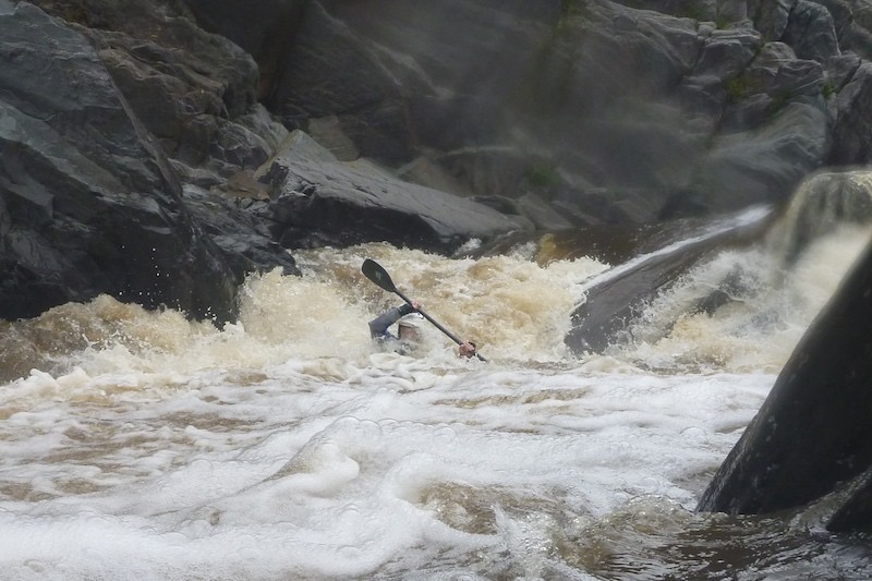
Description: Reasonably consistent grade 3+ water with quite a few falls that needed inspection. Everything could have been paddled but we took the precaution of portaging one major fall of about 4m at about 4hours (midday) and the following rapid as the high water made it tricky.
Finish: Kevin and Greg have wrapped orange safety plastic material around a couple of trees on the river right to signal the take out. Also there are small orange markers on trees to help with the climb out. It is 300m of vertical taking about 1 1/2 hours at an average of 14% but often much steeper. Very difficult!!
The trip was about 7 hours for the on water for probably 25km although the GPS said 30km. The river dropped 240metres so nearly 10metres per kilometre. Put in was at 8am, finished on water at 3pm and after a rest it was nearly 5pm when we reached the cars.
PHOTOS BELOW MAP
Shoalhaven River 30th March 2014: Click on pins for more details
Red is paddling on Shoalhaven River......Green is hiking.....Purple is the car shuttle
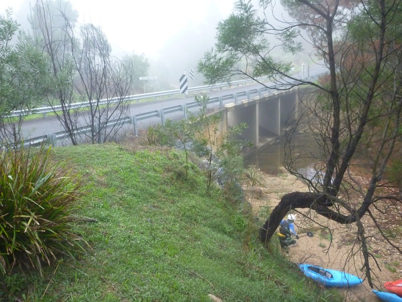
Ningee Nimble Creek Put in at 8am
Boat view
Note broken paddle happened on first rapid
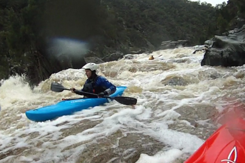
Kevin
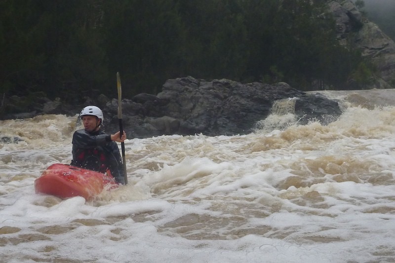
Colin
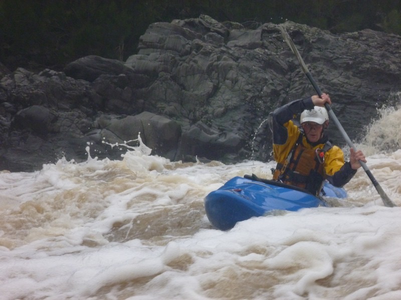
Greg
Jiri
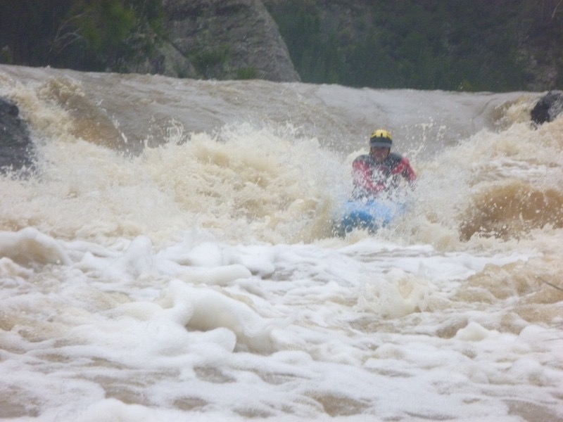
Jiri
Kevin
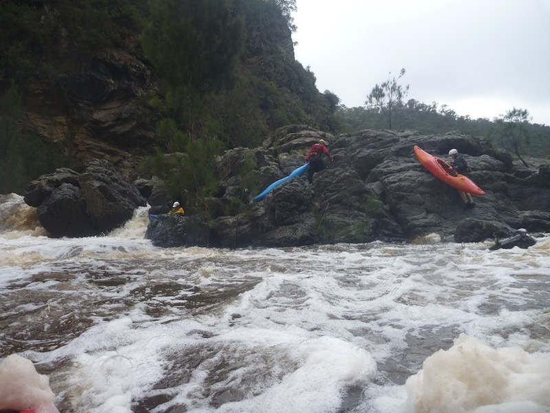
Portage
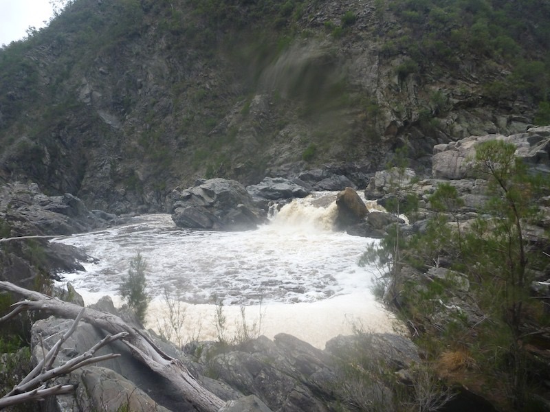
Waterfall we all walked at noon
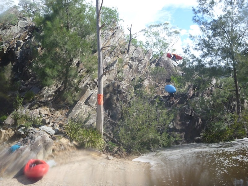
Take out, note the orange markings. 3:30pm starting climb after 30minutes rest.
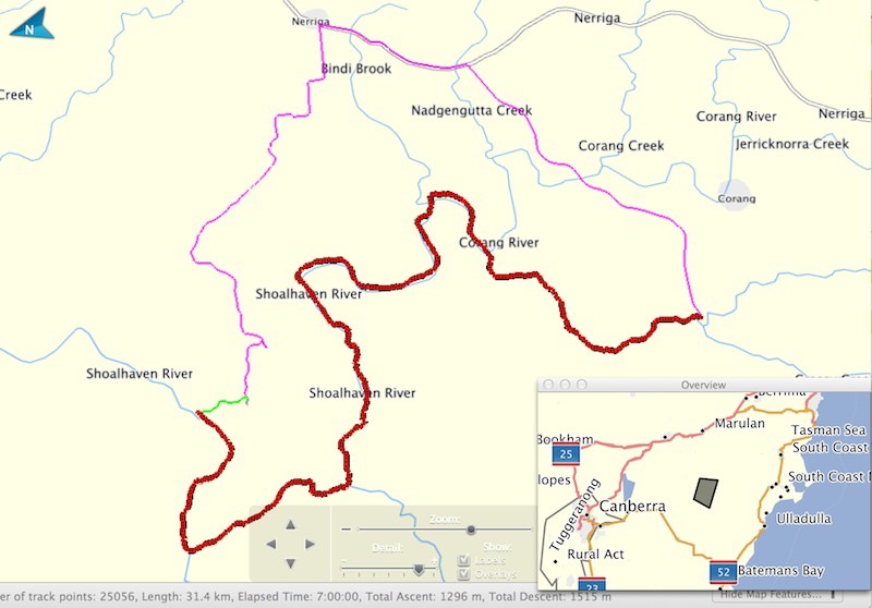
Mud Map of Trip:
Red is paddling, Green is steep climb and purple is car shuttle.
Red is paddling, Green is steep climb and purple is car shuttle.
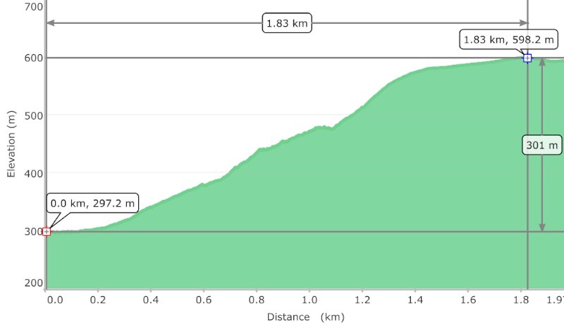
Walk our Profile