

Mountain Biking at Thredbo
16/04/14 20:56 Filed in: MTBing
 One run down the Flow Track before being told NO TANDEMS
Tuesday we checked things out at Thredbo then went back to camp at Thredbo Diggings and rode from there down to Bullock's Flat and on to do a loop around Crackenback Resort and then back to our camp at The Diggings.
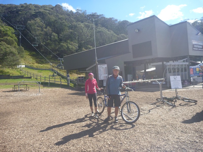
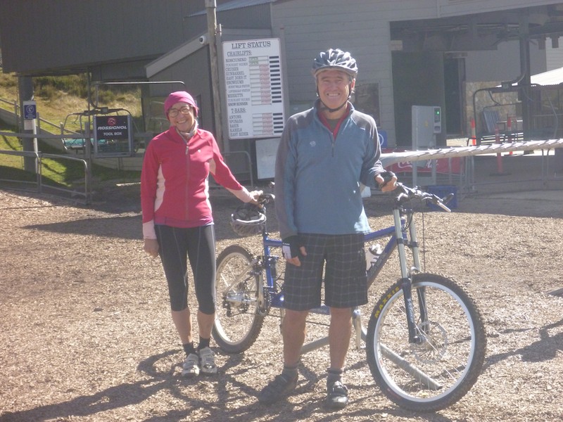
 Wednesday we were up at Thredbo at 9am ready to catch the lift soon after it opened at 9:30. Everything went well, we paid out $69 each plus $5 for a photo ID Thredbo Card and we were on the lift at 9:35. The course starts down the road for a while and then branches off near "Bloody Marys" Restaurant. We took the run quite slowly and as it zig-zags back and forth down the main Crackenback run it makes some tight switchbacks at each side. Some of these were a little washed away, muddy and tight for us on the tandem and we were looking forward to getting them more smoothly on our next run. When we got to the bottom of a pretty fun run, though with the tight switchbacks I think flow course is a bit of a misnomer, we were met by Tim, the supervisor who asked how we had got up, and of course we said on the lift. "Tandems aren't allowed on the mountain" and he motioned to a sign. Although we protested a bit there was no changing there policy which regarded Tandems as "unsafe as the second rider may land on the other if you fall off". Tim was good enough to go and check with "upper management" who only confirmed that. WE got our money back so had one free run.
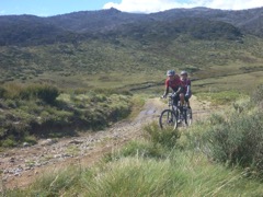 We decided to go further up from Thredbo towards Dead Horse Gap and ride along the "Cascades Trail", a National Parks closed access road that leads 53km all the way to the Barry Way. We crossed a few creeks which certainly got our feet damp and climbed up to Bobs Ridge where we stopped to take in the view. It was then a long descent to The Cascades were we rode through the Thredbo River which was well over chain depth. We just made it out of the water and as we walked up on the other side Annette noticed a bridge for walkers and riders:
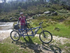 In this photo you can see the Thredbo River behind Annette and on the right of the photo you may be able to make out a metal bridge. On the way back we found it was possible to get around all the creek crossings on either bridges or step-over detours. Anyway we continued on tup the other side and then down and more down until after about 2 hours and 15 km we turned around for the long slog back up the hills to the car. In all it was over 1000m of climbing, and obviously 1000m of descending for an exhausting but fun ride.We headed back to Thredbo and used the electric barbecues in the village to cook our stake for a very late lunch about 4:30 then back to camp at the diggings.
 Wednesday we were up at Thredbo at 9am ready to catch the lift soon after it opened at 9:30. Everything went well, we paid out $69 each plus $5 for a photo ID Thredbo Card and we were on the lift at 9:35. The course starts down the road for a while and then branches off near "Bloody Marys" Restaurant. We took the run quite slowly and as it zig-zags back and forth down the main Crackenback run it makes some tight switchbacks at each side. Some of these were a little washed away, muddy and tight for us on the tandem and we were looking forward to getting them more smoothly on our next run. When we got to the bottom of a pretty fun run, though with the tight switchbacks I think flow course is a bit of a misnomer, we were met by Tim, the supervisor who asked how we had got up, and of course we said on the lift. "Tandems aren't allowed on the mountain" and he motioned to a sign. Although we protested a bit there was no changing there policy which regarded Tandems as "unsafe as the second rider may land on the other if you fall off". Tim was good enough to go and check with "upper management" who only confirmed that. WE got our money back so had one free run.
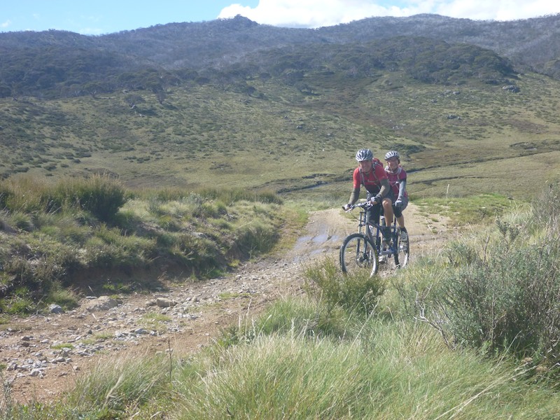 We decided to go further up from Thredbo towards Dead Horse Gap and ride along the "Cascades Trail", a National Parks closed access road that leads 53km all the way to the Barry Way. We crossed a few creeks which certainly got our feet damp and climbed up to Bobs Ridge where we stopped to take in the view. It was then a long descent to The Cascades were we rode through the Thredbo River which was well over chain depth. We just made it out of the water and as we walked up on the other side Annette noticed a bridge for walkers and riders:
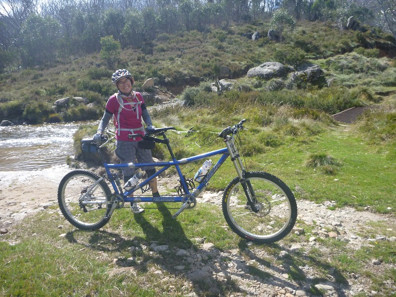 In this photo you can see the Thredbo River behind Annette and on the right of the photo you may be able to make out a metal bridge. On the way back we found it was possible to get around all the creek crossings on either bridges or step-over detours. Anyway we continued on tup the other side and then down and more down until after about 2 hours and 15 km we turned around for the long slog back up the hills to the car. In all it was over 1000m of climbing, and obviously 1000m of descending for an exhausting but fun ride.We headed back to Thredbo and used the electric barbecues in the village to cook our stake for a very late lunch about 4:30 then back to camp at the diggings.